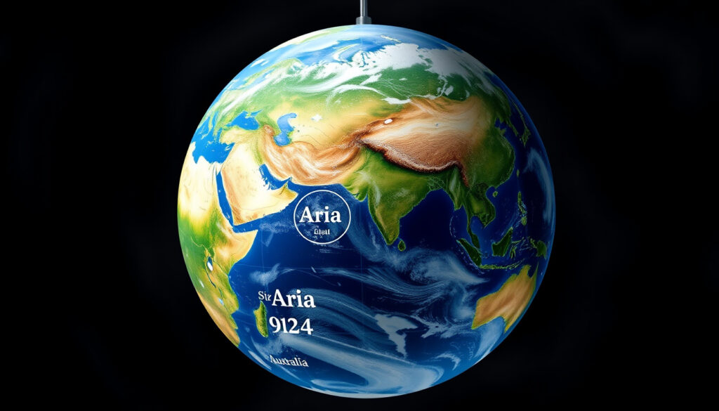
What Are the Continents? 7 Continents List by Size
Most of us memorized the seven continents in school — but the story doesn’t end there. A growing scientific debate asks whether we should count an eighth landmass, one that’s 94% underwater. Geologists have spent years gathering evidence, and a team of researchers just completed the most detailed map of this hidden world. What they found is reshaping how we think about Earth’s geography.
Standard Number of Continents: 7 · Largest by Area: Asia · Smallest by Area: Australia · Most Populous: Asia · Least Populous: Antarctica
Quick snapshot
- Standard 7 continents from largest: Asia, Africa, North America, South America, Antarctica, Europe, Australia (Wikipedia)
- Zealandia covers 4.9 million km², about the same area as greater India (GSA Today)
- 11 geologists from NZ, Australia, and New Caledonia published Zealandia findings in 2017 (Wikipedia)
- Whether Zealandia will gain widespread scientific recognition as a continent
- Whether Oceania should replace Australia in continental models
- If official international bodies will ever standardize continental definitions
- 1995: Bruce Luyendyk names Zealandia (Debate Nirvana)
- 2017: 11 geologists declare Zealandia meets continent criteria (GSA Today)
- 2023: Zealandia becomes first continent fully mapped to underwater edges (GNS Science)
- Broader adoption of Zealandia in geological textbooks and educational materials
- Potential shift from 7 to 8 continents in some educational systems
- Continued research on continent definitions and threshold criteria
The table below consolidates key measurements and classifications from authoritative sources.
| Label | Value |
|---|---|
| Total Recognized Continents | 7 |
| Area of Largest (Asia) | 44.58 million sq km |
| Continents with Countries | 6 (Antarctica has none) |
| Transcontinental Example | Russia |
| Zealandia Area | 4.9 million km² |
| Zealandia Submerged | 94% |
What are the 7 continents of the world?
The traditional seven continents form the backbone of how most of us learned geography. In order from largest to smallest by land area, they are Asia, Africa, North America, South America, Antarctica, Europe, and Australia (Wikipedia — Continent). This ordering reflects raw square kilometers, not population or cultural boundaries.
Asia dominates both categories — at 44.58 million square kilometers, it covers nearly one-third of Earth’s total land area and holds approximately 4.7 billion people. Africa follows as the second-largest continent at 30.37 million square kilometers with about 1.4 billion inhabitants. The two American continents together account for roughly 41 million square kilometers stretching from the Arctic to the tip of Tierra del Fuego.
Asia
Asia stands apart as the world’s largest and most populous continent. It spans from the frozen shores of the Arctic Ocean to the tropical waters of the Indonesian archipelago. The continent includes China, India, and Japan — three of the world’s ten largest economies by GDP.
Africa
Africa covers 30.37 million square kilometers and represents the second-largest landmass. Home to 54 countries, it contains the Sahara — the largest hot desert in the world — as well as the Congo River Basin and vast savannah ecosystems.
North America
North America encompasses 23.2 million square kilometers, stretching from Canada’s Arctic territories to Panama. With approximately 592 million residents, it includes three large countries (Canada, the United States, and Mexico) plus numerous smaller nations in Central America and the Caribbean.
South America
South America covers 17.84 million square kilometers and is home to 434 million people. The Amazon rainforest — spanning Brazil, Peru, Colombia, and other nations — represents Earth’s most biodiverse region.
Antarctica
Antarctica spans 14 million square kilometers but hosts no permanent population. Scientific research stations operated by multiple nations provide temporary habitation. The continent holds approximately 70% of Earth’s fresh water in ice sheets.
Europe
Europe covers 10.18 million square kilometers with approximately 745 million residents across 44 countries. Despite its relatively small size, it contains remarkable diversity — from Arctic Scandinavia to Mediterranean coastlines.
Australia
Australia, at 8.6 million square kilometers, qualifies as the smallest of the seven continents. With 43 million residents, it ranks as both the smallest and the driest inhabited continent. Australia sits entirely within the Southern Hemisphere.
Do we have 7 or 8 continents?
This question sits at the heart of a modern geological debate. The standard seven-continent model remains widely taught, but a growing body of evidence suggests an eighth continent may exist beneath the waves of the southwest Pacific.
Zealandia — a mostly submerged continent that would span approximately 4.9 million square kilometers — was formally proposed as Earth’s eighth continent in a 2017 paper published by 11 geologists from New Zealand, New Caledonia, and Australia (GSA Today — Zealandia: Earth’s Hidden Continent). Only 6% of Zealandia rises above sea level — primarily New Zealand, New Caledonia, and smaller islands.
Seven-continent model
The seven-continent model dominates English-language education. Most English-speaking countries — including the United States, United Kingdom, Canada, and Australia — teach seven distinct continents. National Geographic and most encyclopedic sources reinforce this framework (Wikipedia).
Arguments for eight
Geologists argue Zealandia meets all four criteria defining a continent: elevated terrain relative to surrounding ocean crust, diverse rock types, thicker crust with lower seismic velocity, and well-defined limits spanning over one million square kilometers (CORDIS — Trending Science).
“If it wasn’t for the ocean level, long ago we’d have recognized Zealandia for what it was — a continent,” said Nick Mortimer, a geologist with GNS Science (Science News). Mortimer co-authored the 2014 book “Zealandia: Our continent revealed” with Hamish Campbell.
In October 2023, New Zealand’s GNS Science completed the first-ever full mapping of Zealandia to its underwater edges — a scientific milestone that makes it Earth’s first completely mapped continent (GNS Science).
Zealandia is larger than Madagascar (6×) and Mauritia (12×) — continents everyone agrees on. Yet 94% of Zealandia lies underwater, which complicates intuitive understanding of what a “continent” should look like.
“If we could pull the plug on the world’s oceans, it would be quite clear that Zealandia stands out about 3,000 meters above the surrounding ocean crust.”
— Nick Mortimer, Geologist, GNS Science (Science News)
Hamish Campbell and Nick Mortimer argued that without the ocean level obscuring the view, Zealandia would have been recognized as a continent long ago.
— Hamish Campbell, Geologist, GNS Science (Wikipedia)
Is Oceania a continent?
Oceania presents a classification puzzle. While many people casually refer to Oceania as a continent, geographers and geologists generally disagree with that designation.
Oceania is best understood as a geographic region rather than a continent. It encompasses Australia, New Zealand, New Guinea, and the Pacific island nations of Melanesia, Micronesia, and Polynesia (Wikipedia — Continent). The term “Australasia” sometimes appears interchangeably with Oceania in casual usage, though the two concepts have distinct geographic scopes.
Oceania definition
Oceania covers approximately 1.3 million square kilometers of land distributed across thousands of islands. However, the region lacks the geological cohesion that defines other continents. It represents a cultural and geopolitical grouping more than a geologically continuous landmass.
Australia vs Oceania
Australia is the true continent in the geological sense — a single, continuous landmass sitting atop its own continental plate. Oceania, by contrast, groups together Australia with hundreds of islands scattered across the Pacific. These islands belong to multiple tectonic plates and share no geological unity.
Some educational models replace “Australia” with “Oceania” in continental listings, but this reflects cultural geography rather than geology. Wikipedia notes that some lists include seven geological continents: Africa, Antarctica, Australia, Eurasia, North America, South America, and Zealandia (Wikipedia).
What continents no longer exist?
Earth’s surface has constantly rearranged itself over billions of years through the process of plate tectonics. Continents have collided, split apart, and reformed repeatedly. Two “lost continents” receive particular attention in scientific literature. For more information, click on the surface area of a cylinder. superfície d’un cilindre
Lost continents
Beyond Zealandia — which still exists but remains mostly submerged — geologists have identified remnants of ancient continents that have largely vanished. Pangaea, the most recent supercontinent, fragmented approximately 175 million years ago. Its pieces dispersed to form today’s continents.
Earlier supercontinents — Rodinia (1.1 billion years ago), Columbia/Nuna (1.5–2.0 billion years ago), and Kenorland (2.7 billion years ago) — have similarly dispersed entirely. Only fragments of these ancient landmasses remain visible today as continental cores known as cratons.
Zealandia hidden continent
Zealandia represents a different category: a continent that exists today but remains mostly hidden beneath the ocean. In 2017, a team of 11 geologists published a landmark paper in GSA Today arguing that Zealandia meets the geological definition of a continent despite being 94% underwater (GSA Today).
A 2021 study found Precambrian rocks in Zealandia, providing additional evidence that it represents continental rather than oceanic crust (Wikipedia). These ancient rocks — among the oldest found anywhere — strengthen Zealandia’s claim to continental status.
The pattern reveals that continents are not fixed boundaries but dynamic features shaped by forces operating over hundreds of millions of years.
Geological mapping of Zealandia completed in 2023 represents the first time any continent has been fully mapped to its underwater boundaries. This technical achievement has practical implications for resource exploration, ocean floor mapping, and understanding Earth’s geological history.
Which country falls under two continents?
Several countries straddle the boundaries between continents, creating fascinating geographical anomalies. These transcontinental nations present challenges for geographic classification and political geography.
Transcontinental countries
Russia stands as the most prominent transcontinental country, spanning both Europe and Asia. Its western portion (European Russia) and eastern portion (Siberian Russia) are separated by the Ural Mountains, which traditionally define the continental boundary.
Turkey similarly straddles Europe and Asia, with Constantinople/Istanbul sitting on the European side of the Bosphorus Strait and the remainder of the country in Asia. Egypt crosses from Africa into Asia via the Sinai Peninsula. Kazakhstan spans both Europe and Asia, with a small portion west of the Ural River considered European territory.
Georgia, Azerbaijan, and Cyprus also present transcontinental characteristics, though their continental classifications vary depending on the source consulted.
Russia in Europe or Asia?
Russia’s continental status has generated centuries of debate. The Ural Mountains provide a convenient dividing line, but Russia’s cultural, political, and economic centers of gravity have shifted over time. Moscow, Europe’s largest city, lies clearly within European Russia. However, the majority of Russia’s land area (approximately 75%) lies in Asia.
From a purely geographic perspective, Russia is predominantly an Asian country. From a cultural, political, and historical perspective, Russia identifies strongly with Europe. Most international organizations place Russia in European categories, though this reflects political convention more than geographical precision.
The outcome shows how political boundaries often override geographical realities when classifying transcontinental nations.
Which continent only has 12 countries?
The continent with the fewest recognized sovereign states is Europe, which contains 44 countries — not 12. However, some regional models that include only fully recognized independent states produce lower counts depending on how disputed territories are classified. Antarctica has no countries, while Australia as a continent contains only one sovereign nation: Australia itself.
Oceania as a region — sometimes listed as a continent in alternative models — encompasses 14 sovereign nations, including Australia, New Zealand, Papua New Guinea, Fiji, and several Pacific island states. This count varies depending on whether dependent territories are included.
The discrepancy reveals how regional groupings and continental definitions dramatically affect country counts. Educational systems emphasizing cultural geography tend to use Oceania, while those focusing on geological structure use Australia.
Upsides
- Standard 7-continent model offers simple, familiar framework for global education
- Zealandia recognition could improve ocean floor mapping and resource management
- Clear continental models help standardize international statistics and reporting
- Ongoing debate drives geological research and Earth science understanding
Downsides
- 7-continent model oversimplifies complex geological reality
- No official body exists to standardize continental definitions globally
- Oceania classification confusion persists across educational systems
- Transcontinental countries complicate regional groupings and statistics
Related reading: Carte Feu de Forêt en Cours – Official Maps Québec Canada Europe · Thunder Bay to Winnipeg – Distance, Drive Time, Flights & Bus
While this list ranks the standard seven continents from Asia to Australia, disputed continent counts highlights how classroom answers vary from London to Latin America.
Frequently asked questions
What is the order of continents by size?
The seven continents ranked by area, largest to smallest: Asia (44.58 million km²), Africa (30.37 million km²), North America (23.2 million km²), South America (17.84 million km²), Antarctica (14 million km²), Europe (10.18 million km²), and Australia (8.6 million km²).
How many oceans are there?
The International Hydrographic Organization recognizes five oceans: Pacific, Atlantic, Indian, Arctic, and Southern (Antarctic). However, some sources treat these as four, excluding the Southern Ocean, or treat the Pacific and Atlantic as single connected bodies of water.
What is the population of each continent?
Population estimates vary, but approximate figures are: Asia (4.7 billion), Africa (1.4 billion), Europe (745 million), North America (592 million), South America (434 million), Australia/Oceania (43 million), and Antarctica (no permanent population).
Which continent is coldest?
Antarctica is the coldest continent, with recorded temperatures reaching -89.2°C (-128.6°F) at Russia’s Vostok Station. Arctic regions of North America and Europe also experience extreme cold, but Antarctica’s ice sheets and polar location make it definitively the coldest.
Are there only land continents?
By definition, continents are landmasses. However, the Zealandia debate challenges this assumption — if approved as Earth’s eighth continent, it would be 94% submerged. Some geologists propose the term “mini-continent” for features like Zealandia that fall in a grey zone between continental and subcontinental status.
What defines a continent?
Geologists define continents by four criteria: elevated terrain relative to oceanic crust, diverse rock types, thicker crust with lower seismic velocity, and well-defined limits over a large area (traditionally >1 million km²). These criteria remain somewhat subjective, which explains ongoing debates about borderline cases like Zealandia.
Is Greenland a continent?
No. Greenland covers 2.166 million km² — making it the world’s largest island — but fails the continent test due to its size relative to other landmasses. Australia, at 7.6 million km², holds the distinction of being the smallest continent. Some geologists argue for a minimum size threshold to distinguish continents from large islands, though no universally accepted standard exists.
For geography students and curious readers, the takeaway is straightforward: the seven-continent model works for most educational and everyday purposes, but the Earth itself doesn’t follow textbooks. Zealandia’s recognition as a potential eighth continent represents a genuine scientific development, not merely theoretical speculation. Whether future generations learn seven or eight continents depends on whether geologists can build broader consensus around this mostly-submerged landmass that has waited millions of years for recognition.
More related posts
 John Heard: Life, Career, Net Worth, and Cause of Death
 Situs Slot Gacor108: Facts, Risks & Platform Overview
 Devil Wears Prada 2: Release Date, Cast, Streaming & Reviews
 Conversion Pouce en CM – Exact 1 Inch to 2.54 cm Guide
 Once Upon a Broken Heart – Plot Summary and Character Guide
 World Cup 2026 Tickets: Prices, Dates & How to Buy
 Philippine Peso to Canadian Dollar: Live CAD to PHP Rate